


Additional Videos:  
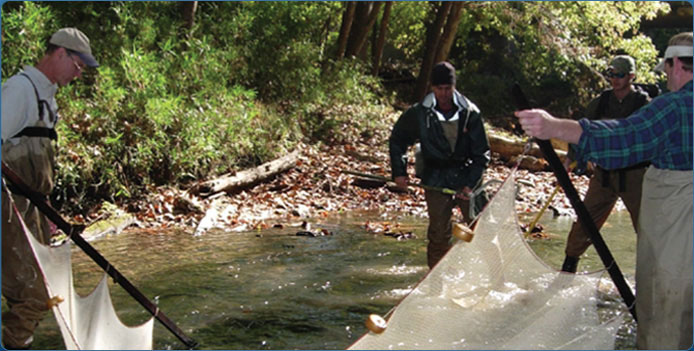
Water is an Important Part of Our Lives Let's Admit it...nothing is as refreshing as a glass of cool water on a hot Alabama day. Although most of us don't think about where our water comes from, we expect it to be clean and safe for ourselves and our families. Let's Admit it...nothing is as refreshing as a glass of cool water on a hot Alabama day. Although most of us don't think about where our water comes from, we expect it to be clean and safe for ourselves and our families.Doing YOUR part to help keep our water clean and safe is easier than you might think. If each person does their part, we can make a huge difference...one person and one drop at a time. Still unsure? See how water affects our jobs, our economy, our health, our real estate prices, and more. What is a Watershed?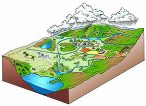 EVERYONE lives in a watershed, although many of us never realize it. Each time it rains, water has to go somewhere. Simply put, a watershed includes all of the land that drains ? or "sheds" ? into a body of water. As rainwater flows to the closest body of water, it comes in contact with anything we pour or place onto the ground. EVERYONE lives in a watershed, although many of us never realize it. Each time it rains, water has to go somewhere. Simply put, a watershed includes all of the land that drains ? or "sheds" ? into a body of water. As rainwater flows to the closest body of water, it comes in contact with anything we pour or place onto the ground.This body of water could be your favorite creek or pond where you skip rocks, the river where you and your family fish, or the ocean you enjoy visiting during family vacations. _________________________________________________________________________________________________________ Continued Website SponsorBig thanks to our website sponsor, the Alabama Sustainable Forestry Initiative (SFI) Implementation Committee. Because of ongoing support from the Alabama Sustainable Forestry Initiative (SFI) Implementation Committee, we will continue to share the exciting news and events from partners that make Team ARSN a success. |
In The News
2025 Alabama Rivers and Streams Network Meeting was a huge success!2025 Alabama Mollusk and Crayfish Working Group Annual Meeting2025 Alabama Rivers and Streams Network Annual Meeting View All News
Upcoming Events
No Events Were Found. View All Events
|